Success with
geospatial information

We are GIS Gruppe Nord GmbH, a forward-looking alliance of three independent offices located in Barnstorf, Hanover, and Scheeßel (Lower Saxony, Germany). With the combined expertise of 150 qualified employees, we bring our capabilities together to reliably deliver complex large-scale projects.
Area of Operation

GIS Gruppe Nord –
based in Northern Germany,
working across Europe

We are based in Lower Saxony and take on projects throughout Europe. Our area of operation is flexible and tailored to your projects and on-site requirements. We carry out precise surveys wherever you need us – accurately and across Europe.
Services

Our services

From geodata acquisition to final delivery, we support complex projects with decades of experience, modern surveying technology, and digital evaluation methods.

Depending on the requirements, we use Mobile Laser Scanning (MLS) for extensive routes and transport infrastructure, Terrestrial Laser Scanning (TLS) for precise 3D surveys, and Airborne Laser Scanning (ALS) for large-scale terrain and elevation data. Using a portable mobile laser scanner, we document buildings and interiors as complete, navigable 3D models.

We process the captured data using, among other tools, CARD/1 and prepare it in accordance with project-specific requirements, for example in the OKSTRA and Kode2000 submission formats. In addition, we create digital terrain models (DTMs), 3D as-built models, and BIM-compliant data foundations.

We develop every surveying solution to meet your specific requirements and deliver precise, reliable geodata for planning, tendering, construction, and documentation.
Request
Business areas

Our Business Areas

Five data-capture methods, one data model: We choose the technology to suit your project — from moving traffic to industrial facilities.
01 Mobile laser scanning for roads and infrastructure
Mobile laser scanning for roads and infrastructure

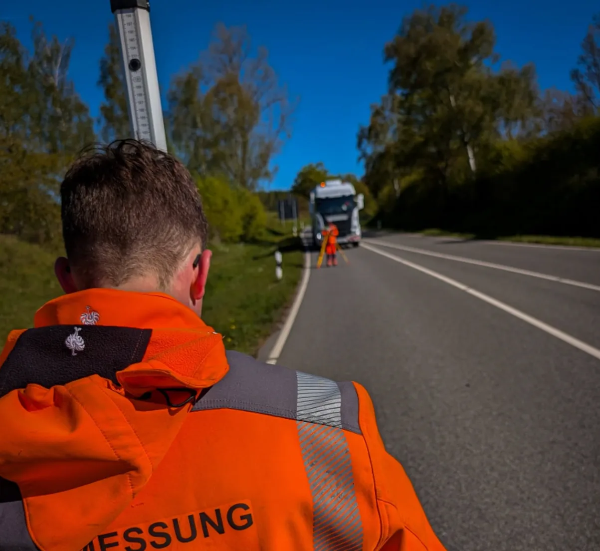
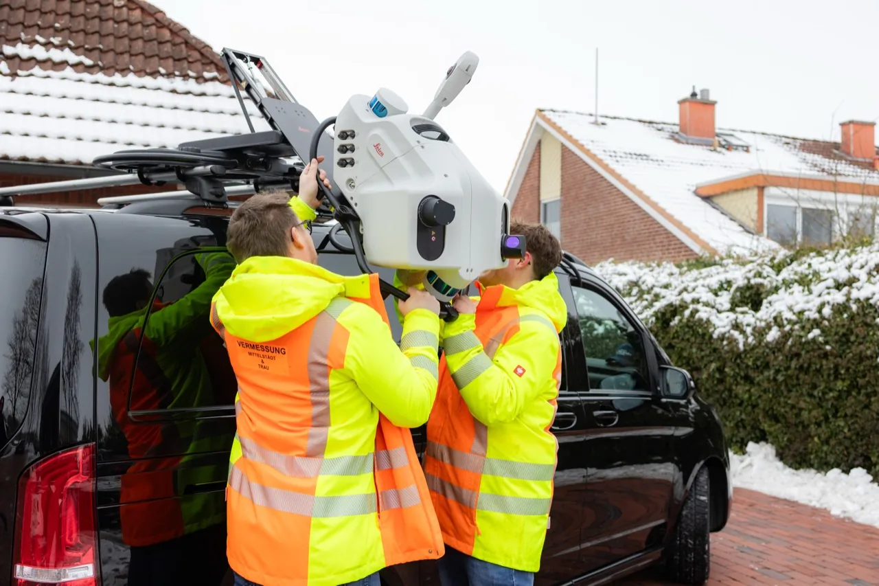
The Leica Pegasus TRK700 kinematic surveying system is redefining the mobile capture of roads and railway infrastructure. For many years, we have been using our extensive experience and proven surveying expertise to capture complete infrastructure corridors under normal traffic conditions. By combining high-precision LiDAR, state-of-the-art camera technology and GNSS positioning, we enable precise, efficient and comprehensive documentation – entirely without disruptive traffic management measures.

Request
  • Digital twin

    We create the precise digital twin for your demanding infrastructure projects.

  • Accurate data for network management

    All clients receive highly accurate as-built data for the rapid construction of transport infrastructure and reliable network management.

  • High-precision surveying of reference routes

    We conduct high-precision surveys of reference routes to validate ADAS systems and navigation data for autonomous driving.

  • LiDAR point clouds

    Our team delivers dense LiDAR point clouds, 3D panoramas, and BIM models that are ready for immediate use.

  • Millimetre-level system accuracy

    By strategically surveying and integrating physical control points, we increase system accuracy to within a few millimetres.
02 Portable mobile laser scanning for complex interior spaces
Portable mobile laser scanning for complex interior spaces

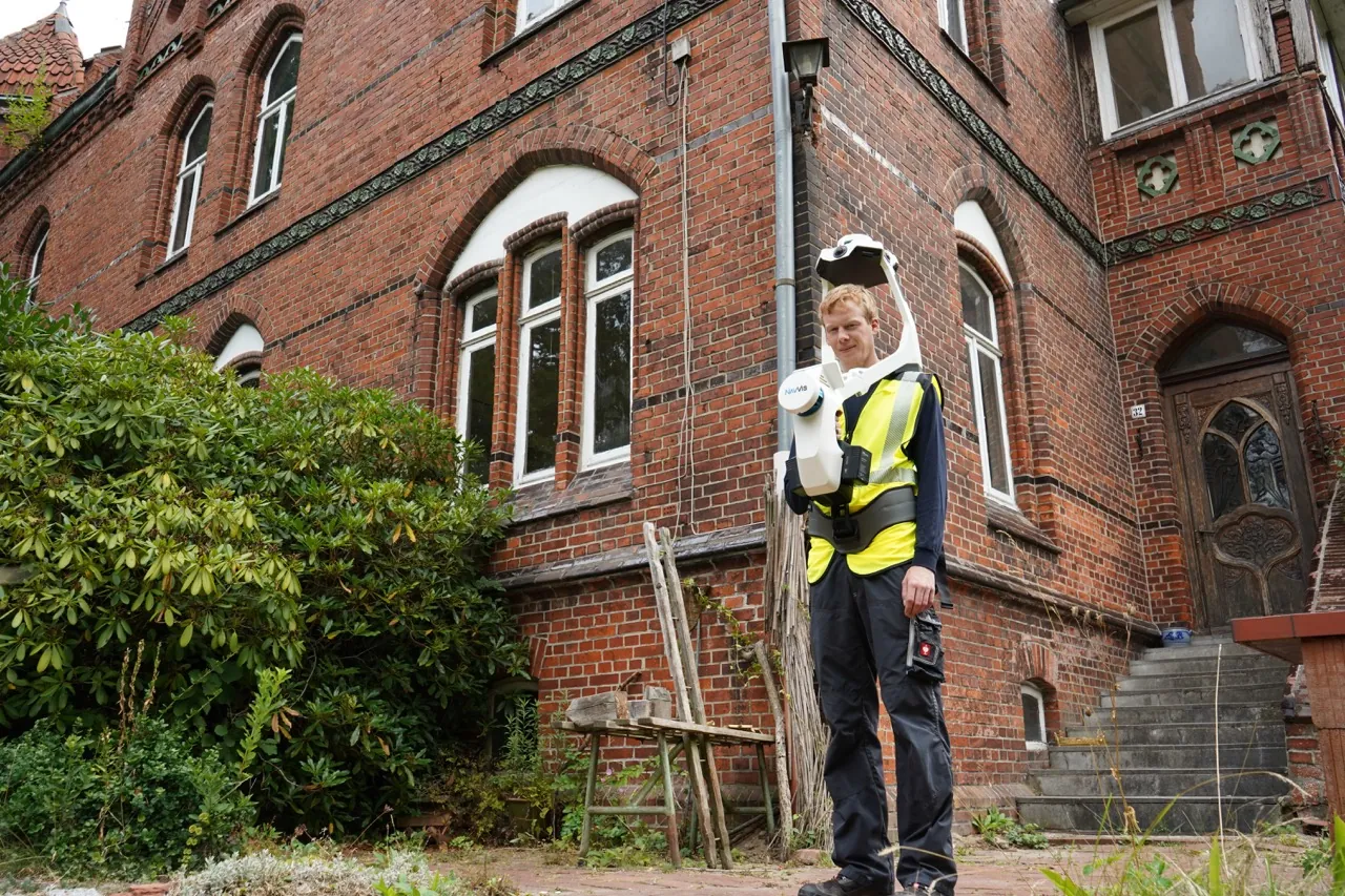
The portable NavVis VLX mobile mapping system is revolutionizing data capture in buildings, industrial facilities, and difficult-to-access terrain. Its innovative technology enables rapid data capture while walking, combining maximum efficiency with high accuracy for projects with tight deadlines.

Request
  • Record-breaking speed

    We capture complex factory halls, industrial facilities, and office buildings in a fraction of the time usually required.

  • Virtual walkthroughs

    As a client you receive dense, colorized point clouds and 360° views for virtual walkthroughs via the IVION platform.

  • BIM models from existing-condition data

    The system provides the ideal data foundation for quickly creating and updating BIM models of existing buildings.
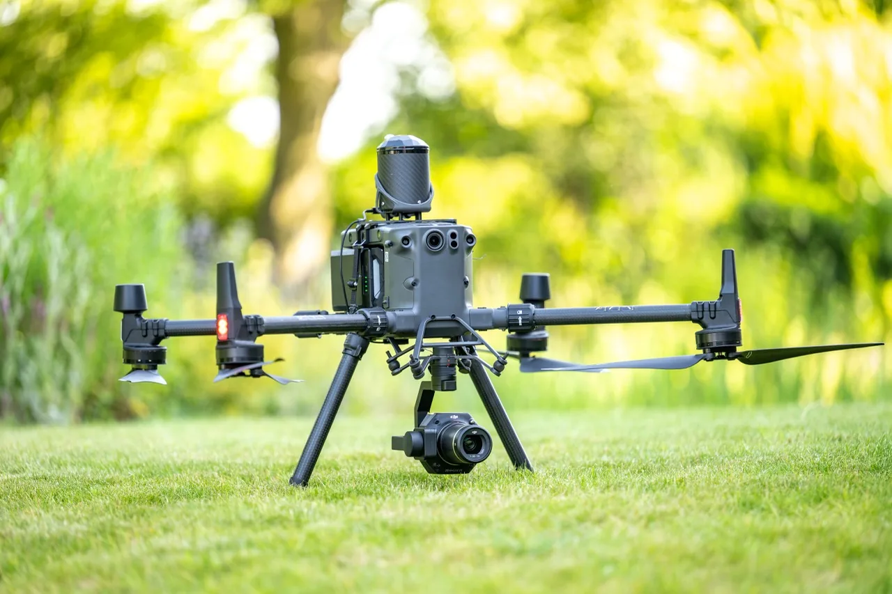
03 Non-contact aerial drone technology
Non-contact aerial drone technology

In modern surveying, conventional methods reach their limits when dealing with extensive or difficult-to-access areas. Our professional surveying drones overcome these challenges effortlessly from the air. Equipped with high-resolution camera systems and RTK positioning, they capture large areas contactlessly, safely, and cost-effectively.

In addition, we rely on state-of-the-art LiDAR technology. Even in poor lighting conditions, dense vegetation, or limited visibility, the LiDAR sensor accurately captures distance and environmental data. This enables the creation of detailed 3D models, digital terrain models, and precise surveys.

Request
  • Digital terrain models

    We generate accurate elevation models as the ideal basis for volume calculations.

  • High-resolution orthophotos

    Using detailed aerial imagery, we create precise site plans, layout plans, and compensation plans.

  • Comprehensive construction monitoring

    We continuously document the current progress of construction and identify structural damage at an early stage.

  • Professional vegetation analyses

    Our technology enables the detailed recording of vegetation and supports the monitoring of biotope development.

  • State-of-the-art LiDAR technology

    Precise capture of distance and environmental data for detailed 3D models, digital terrain models, and as-built surveys.
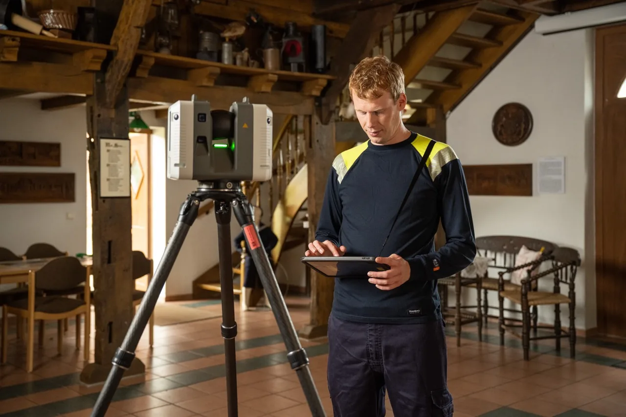
04 High-precision 3D laser scanning for building and plant construction
High-precision 3D laser scanning for building and plant construction

Our 3D laser scanners are the foundation of precise terrestrial surveying. With this technology, we create a complete and highly reliable 3D planning foundation for your project. The system captures complex geometries within seconds, providing the perfect data basis for demanding modelling tasks.

Request
  • 3D as-built surveys for BIM

    We create digital 3D as-built surveys of existing structures for your Building Information Modeling (BIM) projects and for complex buildings during the planning process.

  • Point clouds for plans and calculations

    We provide precise point clouds for the direct derivation of floor plans, cross-sections, volume calculations, and quantity take-offs.

  • Plant and as-built documentation

    Our experts provide professional plant documentation as well as photorealistic as-built documentation for upcoming renovation and conversion projects.

  • Planned-versus-actual comparisons and damage analyses

    We safeguard your project through design-versus-as-built comparisons, detailed damage documentation of structures, flatness inspections, and deformation analyses.

  • Facade documentation and 3D models

    You receive high-quality facade documentation and fully developed three-dimensional models.

05 Geospatial data analysis and customized data processing
Geospatial data analysis and customized data processing

Accurate field data collection is the foundation of every successful project. For your project, we provide professional geospatial data analysis and customized processing of the information gathered. We do not deliver unstructured raw data; instead, we create customized data models precisely aligned with your interfaces and downstream planning and construction processes.

Request
  • Data processing with CARD/1

    We prepare your project data with a high degree of precision using the leading CAD system CARD/1 and various Autodesk solutions, ensuring seamless integration into your infrastructure and route planning workflows.

  • Data exchange in accordance with the OKSTRA standard

    We ensure smooth, standardized data exchange in the road and transport sector through consistent data preparation in accordance with the applicable OKSTRA standard.

  • Coding customized to your requirements

    Our experts structure all surveying data according to your specifications and have extensive experience with a wide range of coding systems.

  • Surveying drainage facilities

    We capture and structure data relating to road drainage systems and inspection chambers in accordance with the ISYBAU standard, ensuring seamless data exchange with planning systems.

  • Classified point clouds

    You receive high-resolution, cleaned and classified point clouds, for example in .E57 or .LAS format. We tailor them to the specific requirements of your CAD and BIM systems.

Result

One survey area,
three methods, one point cloud

Drones, mobile mapping, and laser scanning work together to create one seamless data model of the entire area. The video shows you exactly what the finished result from us looks like.
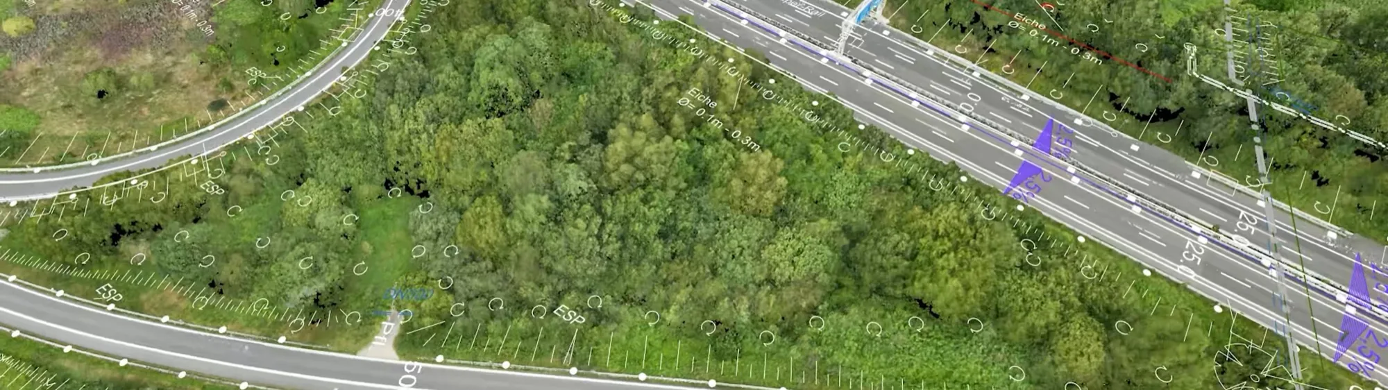
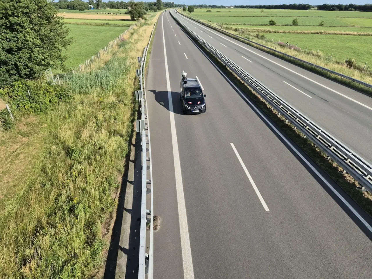
Still from the point cloud video: aerial image with processed survey data
2:36 min
Point cloud · combined capture
01 Drones Aerial mapping and terrain analysis
02 Mobile mapping Corridors in moving traffic
03 Laser scanning Details with millimetre precision
Request
References

Selected projects
from our portfolio

Survey vehicle with mobile laser scanner measuring overhead clearances on the motorway
Measuring overhead clearances on German motorways
We have surveyed more than 10,000 structures using our advanced mobile laser scanner. This helps address the problem of inadequately documented obstacles for heavy-load transport and enables freight carriers to avoid costly delays through precise planning.
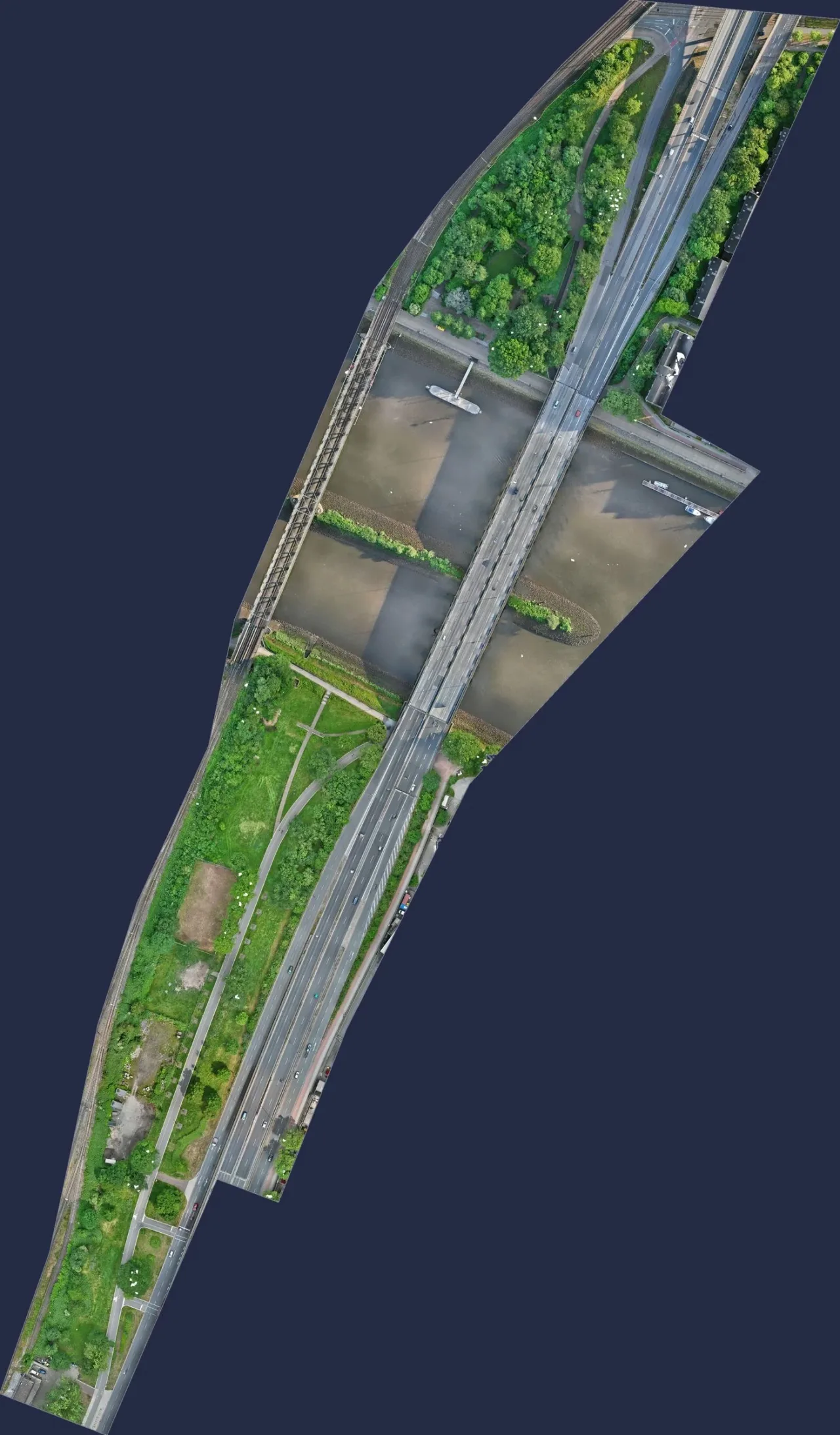
Orthophoto of the Stephanibrücke in Bremen from drone photogrammetry and laser scanning
Precise as-built surveying of the Stephanibrücke Bridge in Bremen
Our team carried out a highly accurate survey of the Stephanibrücke Bridge in Bremen using GNSS, total station surveying, terrestrial laser scanning (TLS), NavVis VLX, and drone photogrammetry. Based on the merged point clouds, we derived detailed as-built road and utility plans as well as an accurate three-dimensional Digital Terrain Model (DTM) in accordance with the Kode2000 standard.
A14 – Road surveying using mobile mapping
For the A14 motorway, we surveyed extensive sections of the road and adjacent areas as a basis for a planned construction project. The Leica Pegasus TRK700 mobile mapping system was used, supplemented by total station and GNSS measurements. The data collected was digitized and delivered in OKSTRA, PDF, and DXF formats.
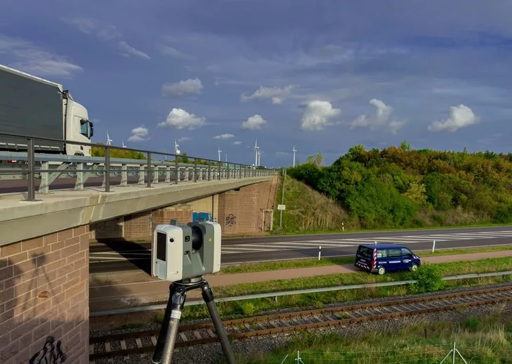
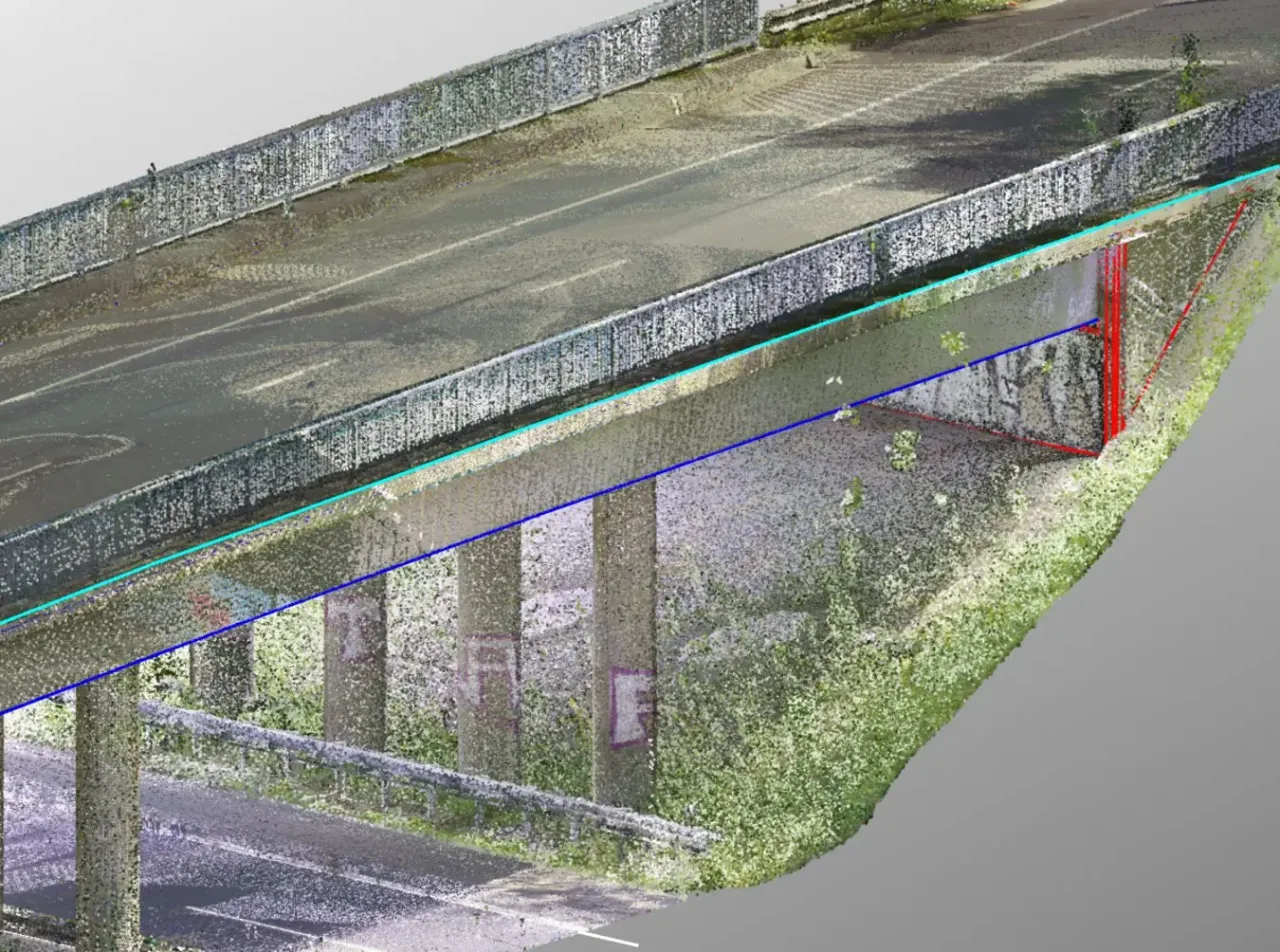
Point cloud of a bridge structure on the A27 near Walsrode from terrestrial 3D laser scanning
Bridges along the A27 near Walsrode
In the area of the A27 near Walsrode, we surveyed three bridge structures, including the adjacent traffic and roadside areas. Terrestrial 3D laser scanning, total stations and GNSS technology were used for this purpose. The results were provided as OKSTRA, PDF and DXF files, as well as a CARD/1 project, for further planning.
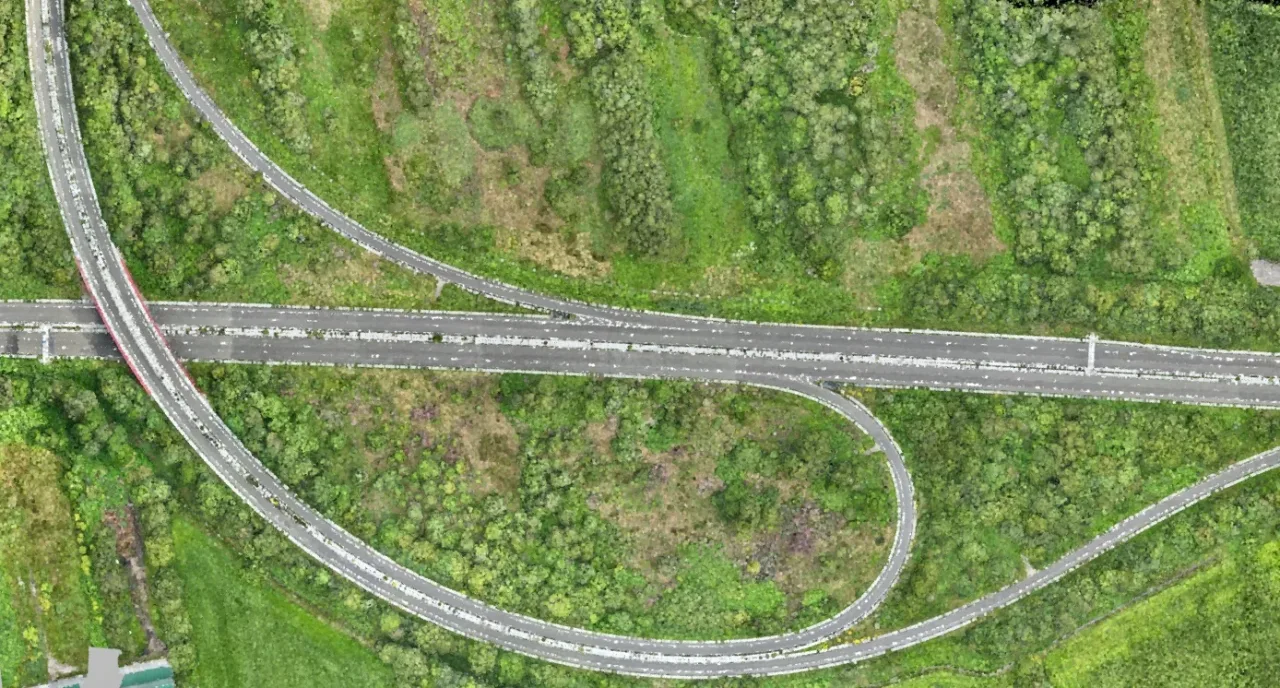
Orthophoto of an A31 junction with loop ramp and bridge structure from the UAV flight
As-built documentation and 3D surveying on the A31
We carried out comprehensive as-built documentation for a section of the A31 motorway. The carriageway and approximately 20 bridges were surveyed using mobile mapping, terrestrial 3D laser scanning (TLS), and LiDAR-equipped UAVs. These methods were supplemented by total station measurements and GNSS surveying. The final deliverables included digital orthophotos, point clouds, and structured road inventory plans.
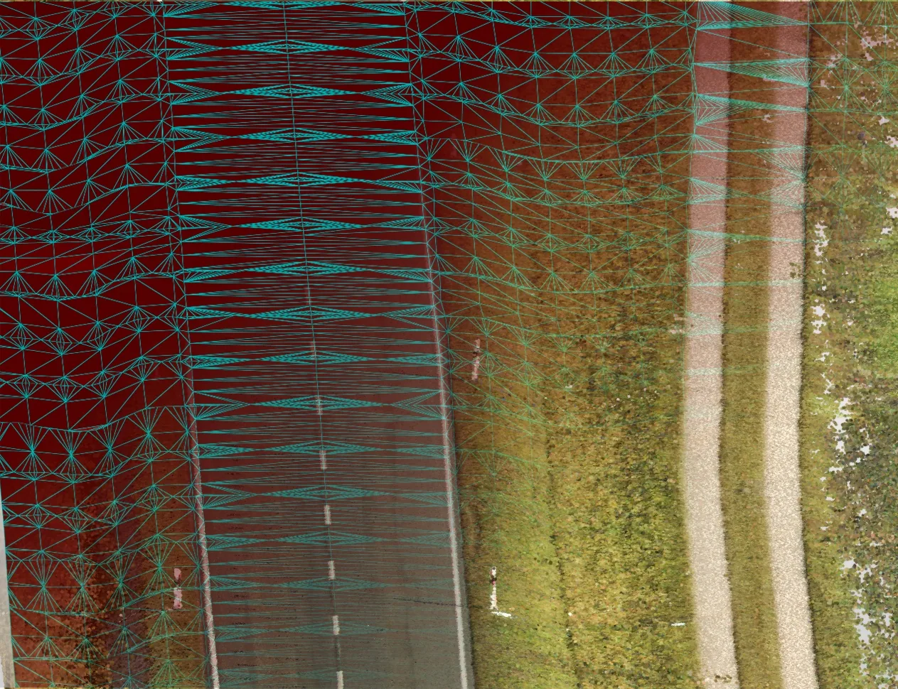
Triangulated digital terrain model of the B107 carriageway from mobile mapping point clouds
Surveying services accompanying the planning of Federal Highways B107 and B187 (Saxony-Anhalt)
Along two federal roads in the Coswig and Oranienbaum area, we georeferenced and surveyed 15 km of roadway to support the upcoming planning process. Using mobile mapping (MLS) and GNSS sensors, all lanes were precisely digitized and tied into the geodetic control network. A 3D segmented road alignment and a digital terrain model (DTM) were derived from the point clouds and delivered as structured 3D as-built data in OKSTRA format.
One alliance. Three offices.

Meet the companies
behind GIS Gruppe Nord

We are GIS Gruppe Nord GmbH, a future-oriented alliance of three independent offices located in Barnstorf, Hanover and Scheeßel (Lower Saxony). With the combined expertise of 150 highly qualified employees, we bring our capabilities together to reliably deliver complex large-scale projects.

Since our foundation in 2005, we have looked beyond the traditional services provided by surveying engineers. We develop future-proof solutions for private companies and public authorities using state-of-the-art geoinformation technology. Detailed geospatial data is essential for making sound business decisions. This is where we come in: we provide the digital foundation you need for your strategic planning. By strategically integrating the latest technologies, we have significantly strengthened our innovative capabilities in the field of three-dimensional documentation.
Request
GIS Gruppe Nord
Barnstorf →
Scheeßel →
Hannover →
Management

The people behind
GIS Gruppe Nord

The managing directors of GIS Gruppe Nord’s three partner offices.
M. Sc. Marc Lambers
M. Sc. Marc Lambers
Publicly appointed surveyor
Lambers und Ostendorf Ingenieure
Aldorfer Str. 1, 49406 Barnstorf
Tel.: +49 (0) 5442 / 9862 - 40
Web: www.lo-ing.de
E-Mail: lambers@gis-gruppe-nord.de
Dipl.-Ing. Dirk Mittelstädt
Publicly appointed surveyor
Vermessungsbüro Mittelstädt & Trau
Vareler Weg 24, 27383 Scheeßel
Tel.: +49 (0) 4263 / 936 - 160
Web: www.mittelstaedt-trau.de
E-Mail: mittelstaedt@gis-gruppe-nord.de
M. Sc. Dmitri Diener
Publicly appointed surveyor
Drecoll Ingenieure
Berliner Allee 13A, 30175 Hannover
Tel.: +49 (0) 511 / 936 816 - 0
Web: www.drecoll.de
E-Mail: drecoll@gis-gruppe-nord.de
Your Contacts

Towards New Horizons

Sven Thomsen
Sven Thomsen
+49 (0) 4263 / 936-501
Gerfried Westenberg
Gerfried Westenberg
+49 (0) 4263 / 936-502